My name is Heidi and I come from Helsinki, Finland.
As we are now living in lockdown, I find comfort in researching online new mountains and nature parks for future hikes. I also like reminiscing with the pictures from our former hikes. This one being one of those. Sierra de Mariola is quite close to Gran Alacant and has many options for routes. We’ve been there before in January issue when we walked around Barranc del Cint. That was quite an easy walk, so this month we explore it for the more adventures hikers. Keep Sierra de Mariola in mind for the future when we have permission to go out to enjoy nature again.
This hike was not an all the way through marked route, so I’ll try to do my best to explain it, as it was an amazing experience. I’d advice to have trekking poles for this hike.
Driving Time: 70 mins
Walking Time: 2 hours/7km
Google maps directions:
Albergue Font De Tarragó, 03838, Plaza Constitución, 7A, 03838 Alfafara, Alicante
We parked our car next to the football court in Font del Tarragó, Alfafara. There’s place for few cars and more space along the road you drive there. The path continues uphill as a really bad condition dirt road. We actually had to move to the bushes to let one car pass us. You can see the red/yellow/white stripes on the roadside. Remember if there’s a painted X that indicates which way NOT to go.
The start of the route is quite steep. After about 500 meters you’ll see an info signpost on your right side. You’ll also see “Senda dels Ibers” signs that we are following.
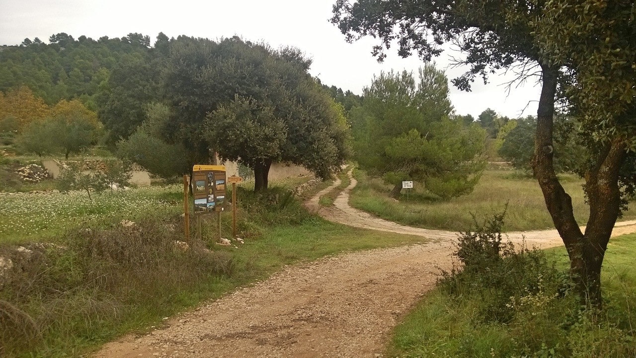
Once you come to a signpost that has route GR 330 signs and PR CV 370 signs, follow the sign that indicates to the Camping de Mariola for just few hundred meters. Soon you’ll come to crossroads with “Senda dels Ibers” signs and bigger info sign. In this intersection you choose to go left and walk between the houses up to the hill. (See picture!)
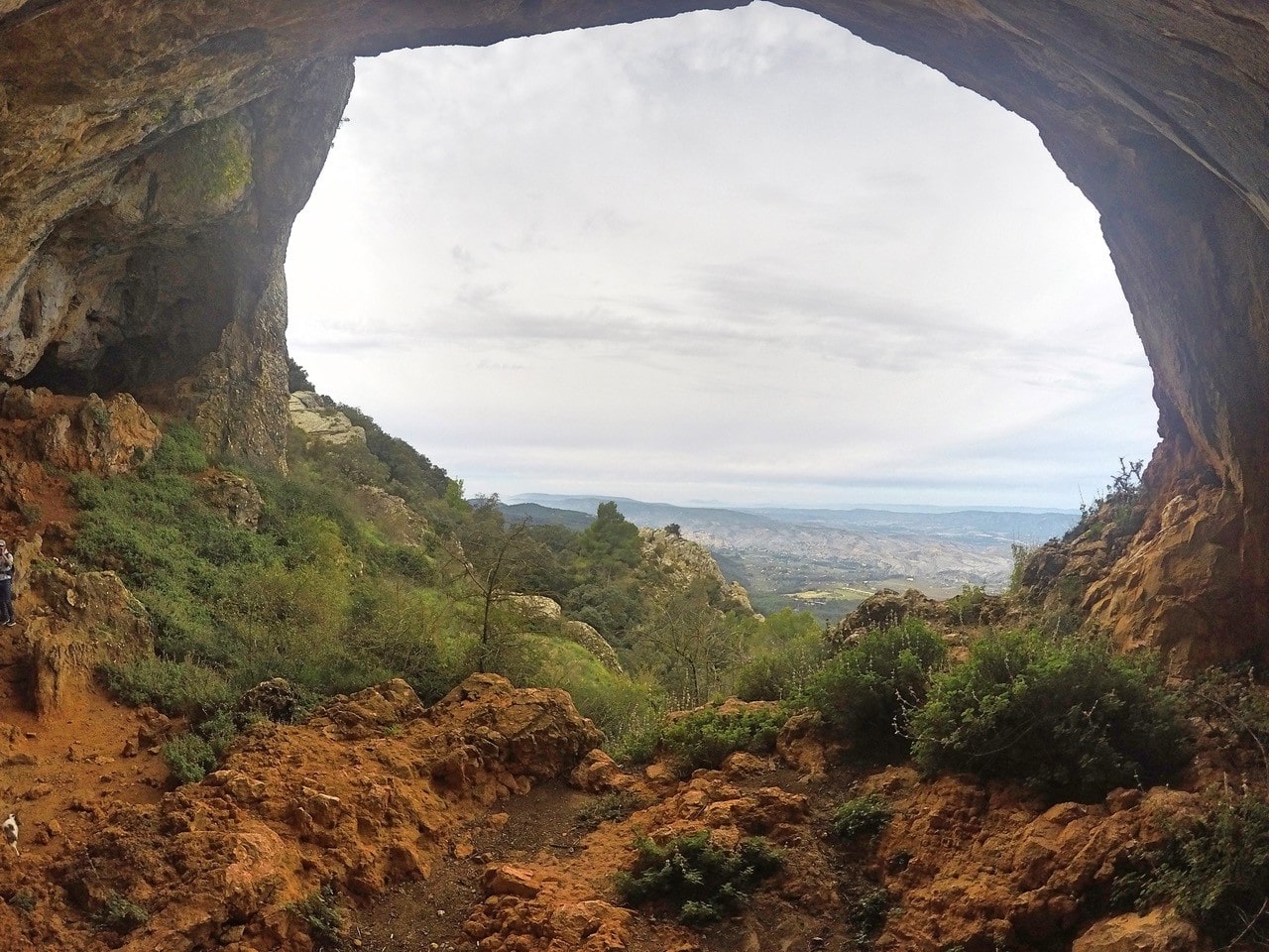
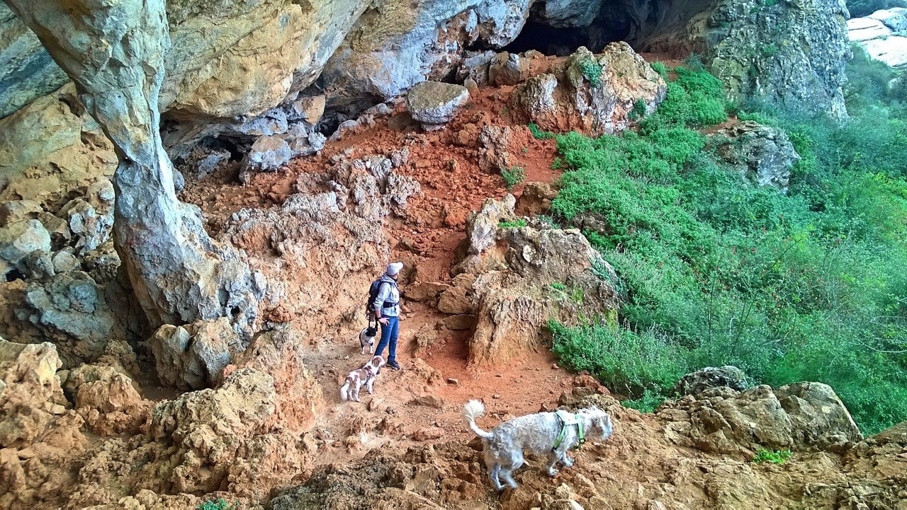
After the houses the path becomes smaller and you’ll walk along the trees uphill until you reach the top. The path will take you over the top to the other side of the mountain which is more adventures side to walk on. From there you descend a bit until you come to the Cova de Bolumini on your right side.
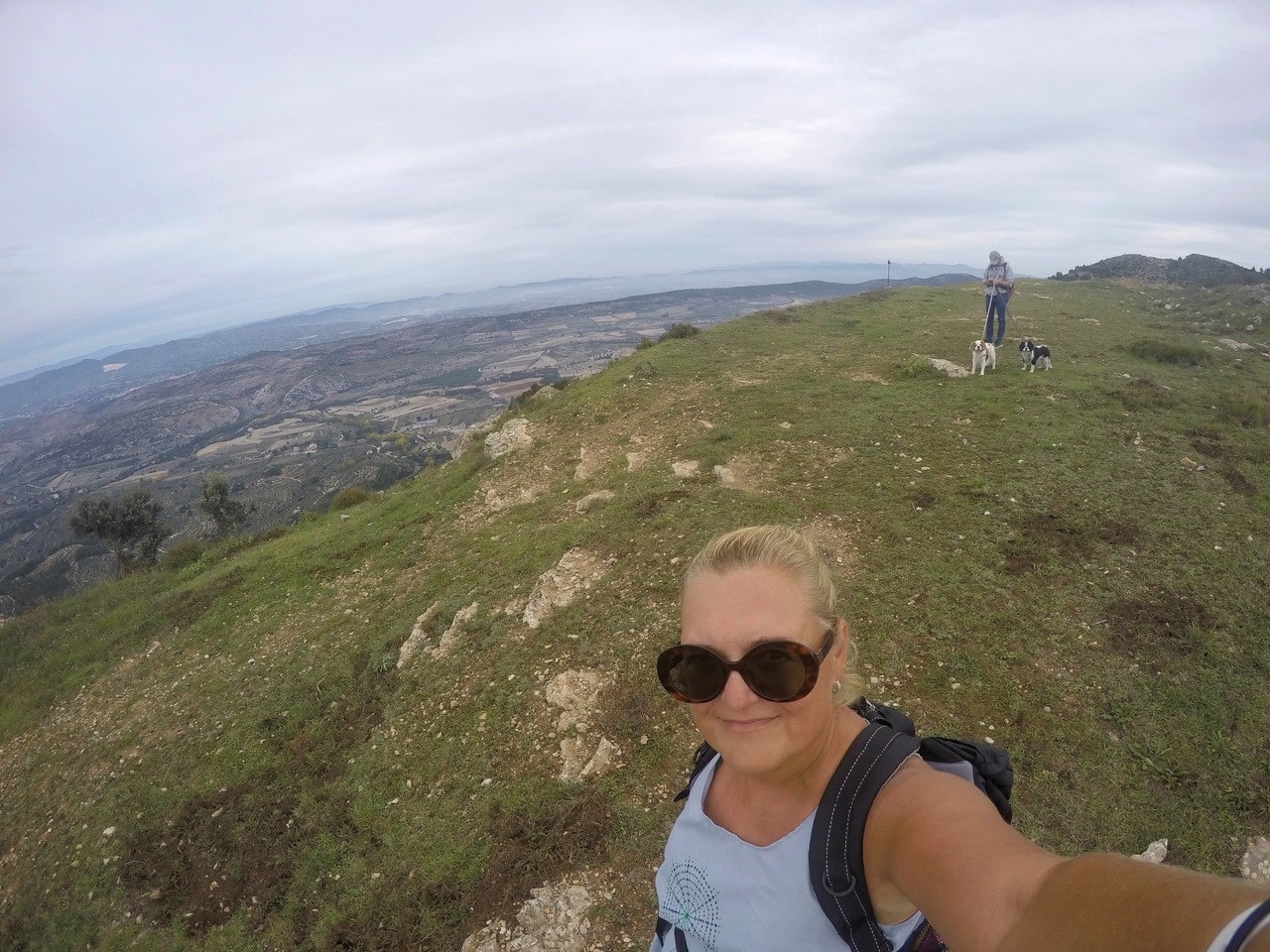
After the caves you continue to go down until you see the signposts taking you to the top of the mountain Cabeçó de Mariola at 1049 meters. You can see Bocairent and Ontinyent from up there. And I’d think all the way to the sea on a clear day.
“Senda dels Ibers” is done by the University of Alicante and it’s marked with explanatory panels (in Spanish). You can experience the nature and the archaeological and ethnographic heritage that surrounds the mountain. Several years of work have been carried out here by the University Institute for Research in Archeology and Historical Heritage (INAPH) and the Camil Visedo de Alcoy Archaeological Museum. Their work shows us what life was like in the area during the Pre-Roman era.
Follow back the “Senda dels Ibers” signs the same way back.
Wishing you all strength to stay at home and hoping that we’ll all be back in nature very soon!
Heidi & Olli x