My name is Heidi and I come from Helsinki, Finland.
With my husband Olli-Pekka and our 3 dogs we live in Gran Alacant and enjoy the brilliant Mediterranean climate and possibility of discovering new hiking routes all over our Alicante province and sometimes even a bit further.
Ironically, I have a fear of heights, but I love the views from tops of the mountains too much to stay away. Our dogs are getting older so all the hikes need to be suitable for them too as they always go on our adventures with us. I also love photography and always take load of pictures from our hikes.
This month we go to Algueña on the border of Murcia and Alicante province. This one will ask strength on legs and good boots. It’s good training for our end of the year hike next month. That will ask some stamina 😉
- Driving Time: 45 mins
- Walking Time: 2.5 hours
- Google maps directions: Algueña, Alicante
This is marked route PR CV 339 and it starts from the Juan Carlos I square in Algueña towards the Plaza de la Iglesia de San José, going down the Calle Mayor towards the CV-841 road that connects Algueña with El Cantón (Murcia). We drove all the way to the mountainside following the PR CV 339 signs past the Casas de la Herrada. The road gets quite narrow, but at the end there’s room to park your car. From that point we’ll continue on foot.

The route takes up the ravine in continuous ascent between rocks and with a very dense vegetation at some points. The climbing took us 1,5 hours for 3,5km, with ascent of about 500 meters. If you walk from all the way from Algueña the ascent will be about 600 meters in total.
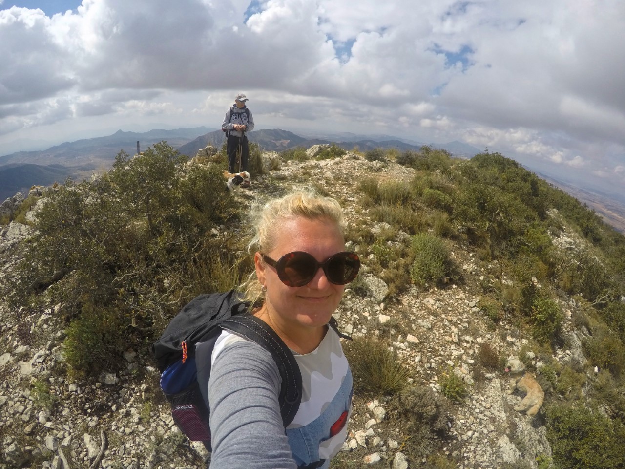
The higher you climb the better views you have over the valleys and mountains. You can see the special pink Alicante marble mining site behind your back going up.
This route felt quite adventurous because in the beginning we really had to go through some vegetation. Early in the morning all the plants and trees were dripping with dew, which did wet our clothes. But everything dried fast as it usually does.

The route is very straight forward up and down the same way. It’s marked very well and you can see where you are coming from all the time. Very enjoyable route and quite a good amount of exercise with fantastic views to Alicante, Murcia and even province of Albacete.
Hope you enjoy this lovely hike,
See you next month,
Heidi & Olli
Check List:
Always when going on hikes check that:
Your Mobile Phone is fully charged
Water – climbing up is hard job & you will need it
Snacks (Remember to take all the garbage back down with you!)
Have good shoes for walking
Have small first aid kit with you
Have layered clothes. Up hill might be
– very windy and cold, even on a warm day.
– Coming down might be chilly, so extra dry
– t-shirt to change into if needed is not a bad idea
Always tell someone where you are going and when you’ll approx. be coming back

