My name is Heidi and I come from Helsinki, Finland.
With my husband Olli-Pekka and our 3 dogs we live in Gran Alacant and enjoy the brilliant Mediterranean climate and possibility of discovering new hiking routes all over our Alicante province and sometimes even a bit further.
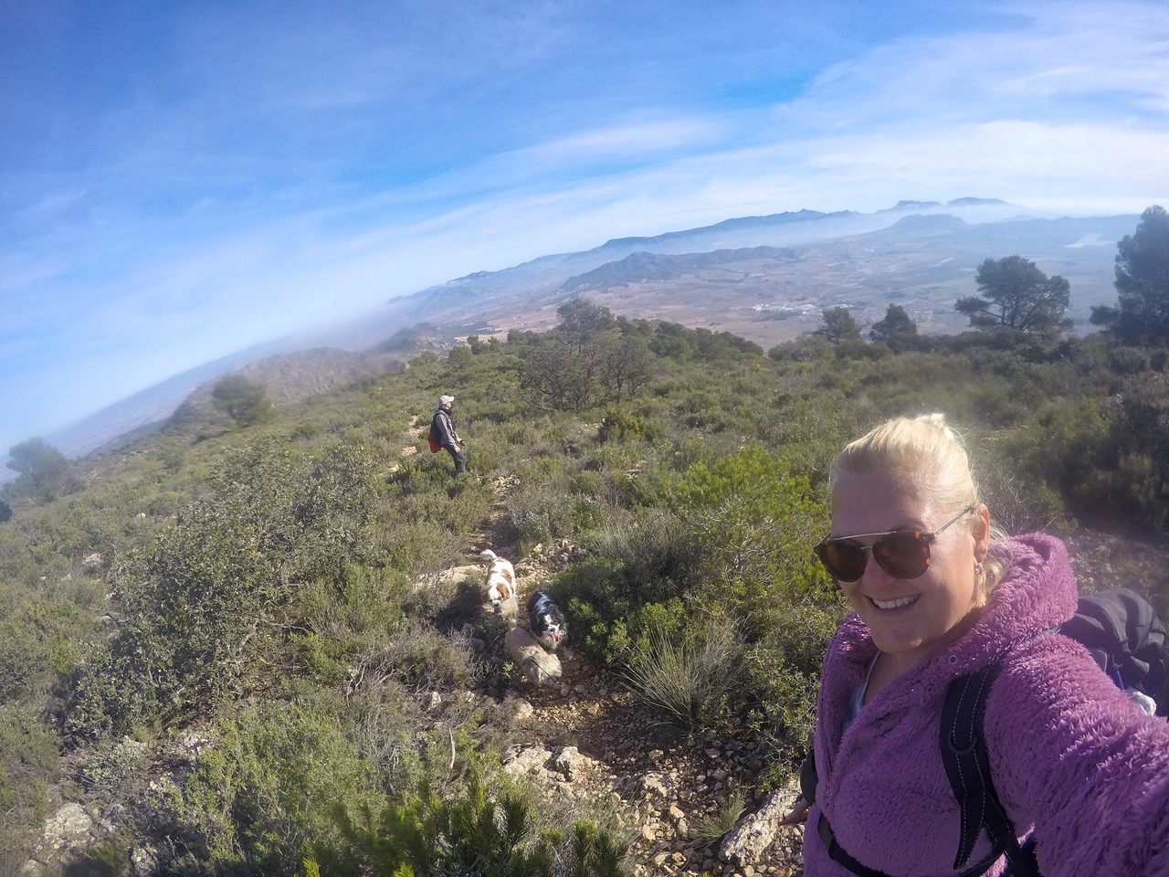
Ironically, I have a fear of heights, but I love the views from tops of the mountains too much to stay away. Our dogs are getting older so all the hikes need to be suitable for them too as they always go on our adventures with us. I also love photography and always take load of pictures from our hikes.
This route gives you panoramic mountain landscapes in 360°. If you are able to climb steep hill with some loose rocks for an hour, this route is for you to enjoy. We go up to the peak at 1049 meters and come back the same way.
- Driving Time: 55 mins
- Walking Time: 3 hours
- Google maps directions: Calle Rambla, 03638 les Salines d’Elda, Alicante
This is part of the route PR-CV 159.
It’s quite well marked. Just follow the narrow footpath, white and yellow painted stripes and man made rock formation to keep on route. Once you have done the hardest climb, the path goes lightly uphill left all the way until you see the mark of the peak El Caire on the next hilltop. That’s where we are heading!

We drove our car to the little Park Ermita in Salinas. Right there next to the road you can spot the wooden signs indicating you to the route PR-CV 159. Naturally you go uphill.
It took us about an hour to get through the toughest climb. We did take few brakes to drink and to undress excess layers of clothing. The thermometer was at 4°C when we got out of the car, but the climb made us sweat bullets. When we got back to the car it was 15°C.

You don’t have to climb much to get to enjoy the spectacular views. It is absolutely stunning up there. Especially in the morning with some fog and clouds hanging down. It’s like being on top of the world.
The whole route up to the peak and back took us about 3 hours. On our way back we took a lunch break and enjoyed the sun and the landscape.
We climbed about 450 meters up. The route in total was only about 5,5 km. The hill is quite steep, so pair of trekking poles would be very useful. Especially when coming downhill with the loose rocks. Be careful!
This hike was very tranquil. We saw absolutely no one. Heard only birds chirping and some odd airplanes go by. If you wanna clear your head, enjoy endless mountainscapes and have a good workout, this one is for you!
Next month we go on foot again,
Hasta luego,
Heidi & Olli
Check List:
Always when going on hikes check that:
Your Mobile Phone is fully charged
Water – climbing up is hard job & you will need it
Snacks (Remember to take all the garbage back down with you!)
Have good shoes for walking
Have small first aid kit with you
Have layered clothes. Up hill might be
– very windy and cold, even on a warm day.
– Coming down might be chilly, so extra dry
– t-shirt to change into if needed is not a bad idea
Always tell someone where you are going and when you’ll approx. be coming back

