My name is Heidi and I come from Helsinki, Finland.
With my husband Olli-Pekka and our 3 dogs we live in Gran Alacant and enjoy the brilliant Mediterranean climate and possibility of discovering new hiking routes all over our Alicante province and sometimes even a bit further.
Ironically, I have a fear of heights, but I love the views from tops of the mountains too much to stay away. Our dogs are getting older so all the hikes need to be suitable for them too as they always go on our adventures with us. I also love photography and always take load of pictures from our hikes.
This is a hike I’ve been thinking about for a long time. Obispo peak is at 2015 meters, making it the highest peak in Murcia region. Highest peak in Alicante is in Aitana and it reaches 1558 meters.
- Driving Time: 2 hours
- Walking Time: 6 hours
- Google maps directions: Inazares, Murcia
The route starts from the village of Inazares, which is the highest inhabited village in all of Murcia at 1350 meters. It also has the clearest sky of all of Peninsula. If you are into night sky photography, this village is the place for you!
In the middle of little Inazares village there are info signs of the route and of the nature and animals you might be lucky enough to see. Right before you reach the village, on the right side, there’s a sign for a parking lot. From the parking lot you just walk few hundred meters along the road to the starting point of the route.
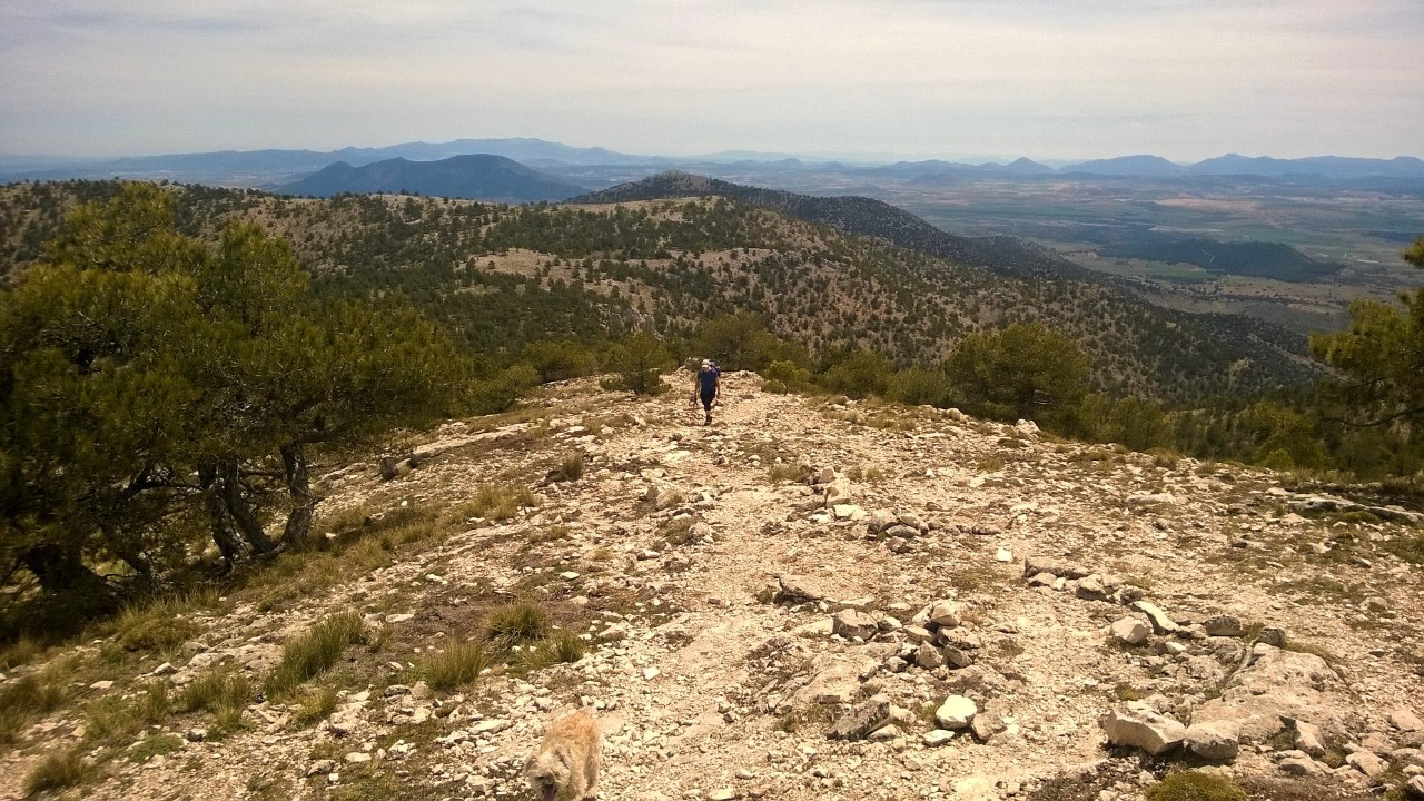
The route took us nearly 6 hours, but we did have 2 longer breaks to eat and drink and rest our feet. The climb up to the peak is 7 km, with one longer and steeper section and few very small sections were you can rest your legs going down. Otherwise it’s quite nice and steady way. And easy path to come down because it’s not so steep.
Follow the white and yellow stripes on the ground and on top of sticks. Also keep an eye on manmade rock formations which indicate the route in most parts.

The only difficult thing about this route for us was, that there’s another path (from another village from another side of the mountain) coming up to the peak too and it’s marked with exactly the same kind of markings and seems to be bit clearer to follow. On our way down, we mistakenly crossed to that path and it took a while until we realised that we were on the wrong hillside. So with tired feet, we needed to climb back and find the path that we came up with, and follow that back to the village.
As the route is 7 km long for one direction, one can’t remember all the landmarks on the route. If you want security, it might be a good idea to have few red ribbons or something like that and leave them for yourself to pick up on your way back, to make sure you are on the right path. This mountain is so hilly that it’s feels like it could be easy to get lost.

Otherwise I really enjoyed this challenge and the route and the scenery. We were wearing mountain boots, but we feel like you could do this with good trainers too. If you go when there’s snow on the ground, then I suggest you have good boots and walking sticks with you.
On our way back we saw about a dozen eagles flying on the mountainside. That was amazing. There were lots of mountain goat droppings everywhere, so they were around, but did not show themselves to us.
Elevation on this route is 800 meters. So even if the route itself does not have difficult sections, the hike is so long that you need to have some strength to do this and lots of snacks and water.
On this route the peak of Obispo comes first. You can also visit the peak of Revolcadores at 1999 meters. You see the same pointy cylinder perhaps 1,5 km away. We saw some murky skies nearing us, so we just headed back to car from Obispo. But if you need bigger challenge there is always that added option.
Hope you enjoy this hike,
See you next month,
Heidi & Olli
Check List:
Always when going on hikes check that:
Your Mobile Phone is fully charged
Water – climbing up is hard job & you will need it
Snacks (Remember to take all the garbage back down with you!)
Have good shoes for walking
Have small first aid kit with you
Have layered clothes. Up hill might be
– very windy and cold, even on a warm day.
– Coming down might be chilly, so extra dry
– t-shirt to change into if needed is not a bad idea
Always tell someone where you are going and when you’ll approx. be coming back

