My name is Heidi and I come from Helsinki, Finland.
With my husband Olli-Pekka and our 3 dogs we live in Gran Alacant and enjoy the brilliant Mediterranean climate and possibility of discovering new hiking routes all over our Alicante province and sometimes even a bit further.
Ironically, I have a fear of heights, but I love the views from tops of the mountains too much to stay away. Our dogs are getting older so all the hikes need to be suitable for them too as they always go on our adventures with us. I also love photography and always take load of pictures from our hikes.
The start of the route is right next to the Santuari de la Mare de Déu de Gràcia. There’s a good parking space available with picnic tables and garbage bins. This area is a starting point for many routes. We will be definitely going back to Biar to try another route.
Driving Time: 45 mins
Walking Time: 3 hours
Google maps directions: Santuari de la Mare de Déu de Gràcia, Diseminado Santuario, 2, 03410 Biar
With this route you start with PRV 55 up the hill. Some mountain bikers might be coming down this route so be aware of that. The route is very well marked and easy to follow. No difficult sections, but you need some strength to go up nearly 500 meters and 11 kilometres.
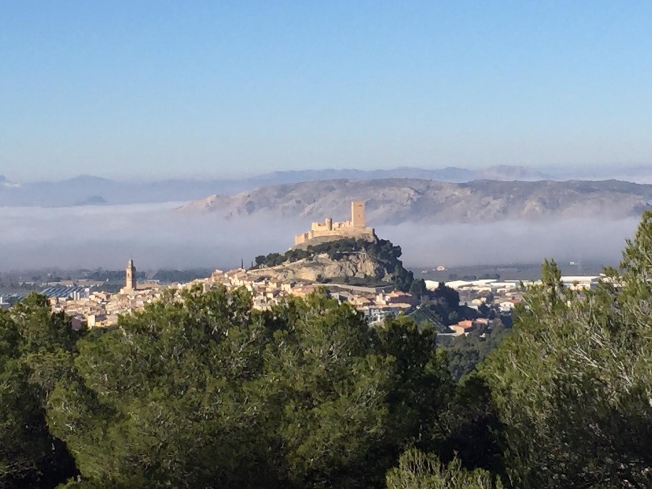
 As soon as you start going up, look behind you to experience the lovely looking Biar in the midst of valley between the mountains. When we did this route we drove through dense fog to Biar. I was starting to be desperate that our hike will be done without visibility. But our starting point was already up at 800 meters, so we could see the fog below us creating beautiful landscapes.

Once you’ve climbed up the first hill, you will come to an area that is used for  parking cars. There’s also a fairly big water tank opposite to you. This spot is where we return from the peak Reconco and go back the same way.
Continue the road with the white and yellow stripes few kilometres having the mountain top on your right side. There will be a fountain font de Soriano about half way of this section.
 Once you come to the cross paths with a sign “Sender Botànic” continue to follow those signs. This route will take you to the peak Recocnco at 1209 meters. On the route there are few signs telling about the bushes and trees you see on your way.
After some more climbing you will reach the asphalt road. Continue up to enjoy the spectacular views over Biar and it’s surroundings from the peak. Then follow the asphalt road back to the parking lot area with the water tank and continue downhill the same path you came up.


In the picnic area you can see information about what to see in Biar. So if you are not up for a hike to the peak, there’s definitely lots to see in Biar. And what better place to start than the beautiful Santuary surroundings.
Hope you enjoy this lovely hike,
See you next month,
Heidi & Olli