My name is Heidi and I come from Helsinki, Finland.
With my husband Olli-Pekka and our 3 dogs we live in Gran Alacant and enjoy the brilliant Mediterranean climate and the possibility of discovering new hiking routes all over Alicante province and sometimes even a bit further.
Ironically, I have a fear of heights, but I love the views from the top of the mountains too much to stay away. Our dogs are getting older so all the hikes need to be suitable for them too as they always go on our adventures with us. I also love photography and always take lots of pictures on our hikes.
- Driving Time: 50mins
- Walking Time: 3 hours
- Google maps directions: Aparcamiento Hotel Xorret de Catí, 03420 Castalla, Alicante, Espanja
The route starts near the hotel in Xorret de Catí. There should be space in the parking lot. Walk a little bit main road downhill from the hotel and to your right side you’ll soon see the PR-CV 28 sign uphill. That’s where our route starts. Remember that the route is indicated with the white and yellow = mark. You are following route PR-CV 28. You go up to the peak and down the same way.

If you want to you can choose different way back. There are lots of marked routes in the area. If you want to cheat a little bit (half the route) drive past the hotel until you reach “refugios” area to your left side. Park the car to the side of the road. Only personnel are allowed to park to the service area (even when it doesn’t say that you can’t drive there). When we visited the gate was open and we drove to “refugios” area, but were told that the car has to be removed. Which was good, because the gate was closed when we got back! Walk to the dirt road and the route continues straight ahead when the drive way is taking a steep turn to left.

Most of the route to the peak (cumbre del Despeñador) was wide (dirt road for car), towards the end it gets more narrow and challenging. There are couple of places that a child would possibly need a little bit of help, but otherwise it was very suitable for children too.

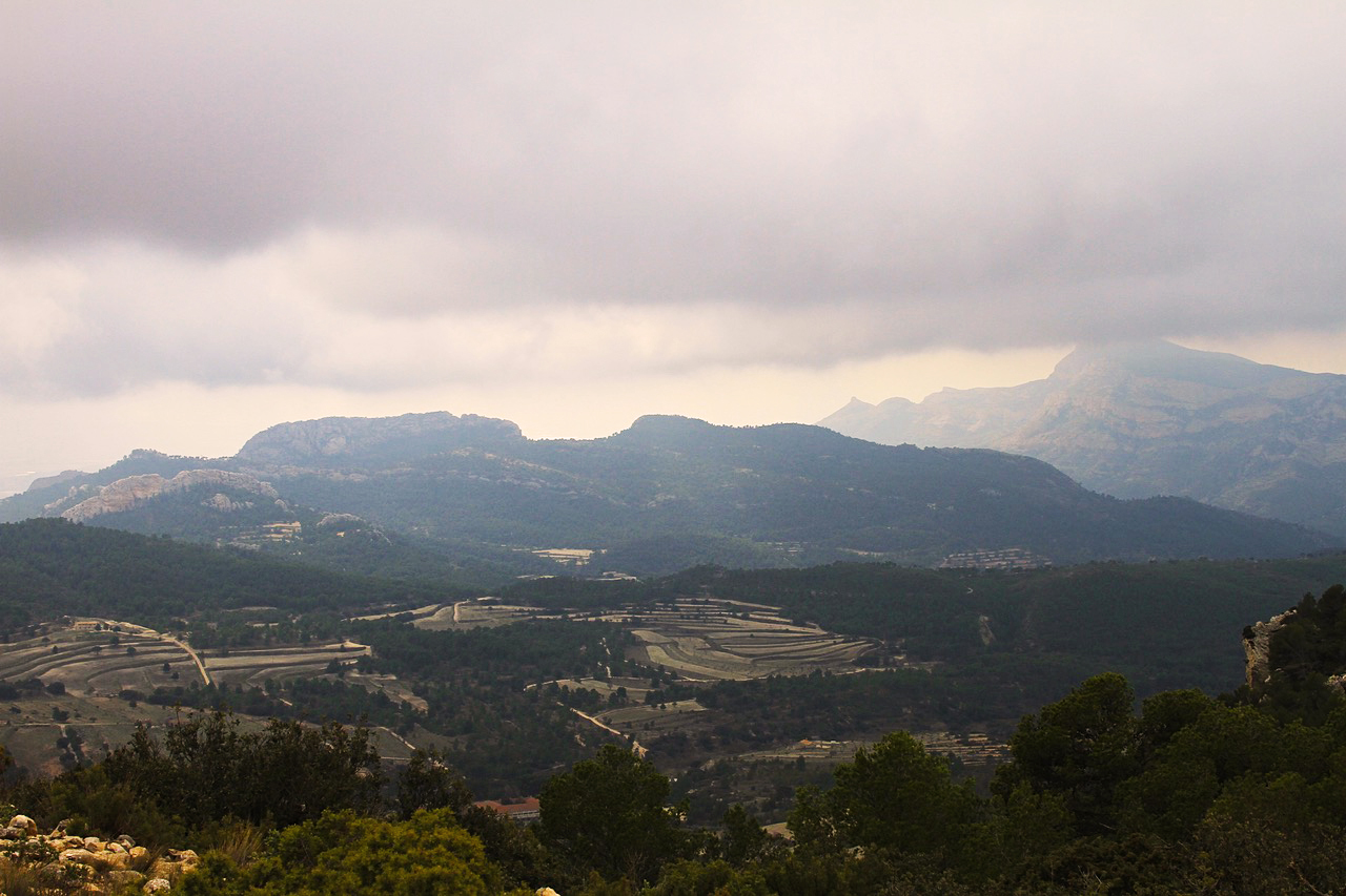
Our hike took place on a cloudy day. But even then the hike was enjoyable and views very impressive. I read that this is considered one of the most important leisure areas of Alicante and a reference area for the traditional practice of mountain sports. There is a climbing wall near the Mirador de Catí. You’ll find the path to the Mirador de Catí after the personnel parking area of the “refugios”. Sierra del Maigmó has maximum altitude of 1,296 m peak of the same name, and occupies an area of approximately 1,280 ha.

Sierra del Maigmó is located between the municipal districts of Tibi, Castalla, Agost and Petrel, bordering on its summit the three municipal districts. The climate is Mediterranean, slightly continentalized, due to the altitude it has. Rains usually are abundant, mainly in the months of autumn. The snowfalls are predominant in all the mountain range, nevertheless the frosts are frequent at night. At the peak of Maigmó (1,296 m) temperatures can drop below -10 ° C and in summer exceed 30 ° C. The clouds at the summit are usually constant in the winter and autumn months, and therefore facilitate precipitation in this area. It’s green forest area where you can encounter wild boars.
Next month we go on foot again, Hasta luego, Heidi & Olli
Check List:
Always when going on hikes check that:
Your Mobile Phone is fully charged
Water – climbing up is hard job & you will need it
Snacks (Remember to take all the garbage back down with you!)
Have good shoes for walking
Have small first aid kit with you
Have layered clothes. Up hill might be
– very windy and cold, even on a warm day.
– Coming down might be chilly, so extra dry
– t-shirt to change into if needed is not a bad idea
- Always tell someone where you are going and when you’ll approx. be coming back