- Driving Time: 1hour
- Walking Time: 5+ hours
- Google maps directions: Partida Campos, 13, 03440, Alacant, Espanja
Once again bit tricky to explain where to park your car. You can always go back to the Ibi factory area at Avenida Joaquín Vilanova and park there and walk about 700 meters back to this point that you see in the picture below. Before the little bridge turn right and leave your car there. Start walking along the ravine uphill. You’ll walk past an old mill and some houses. The route is marked with white and yellow = markings.
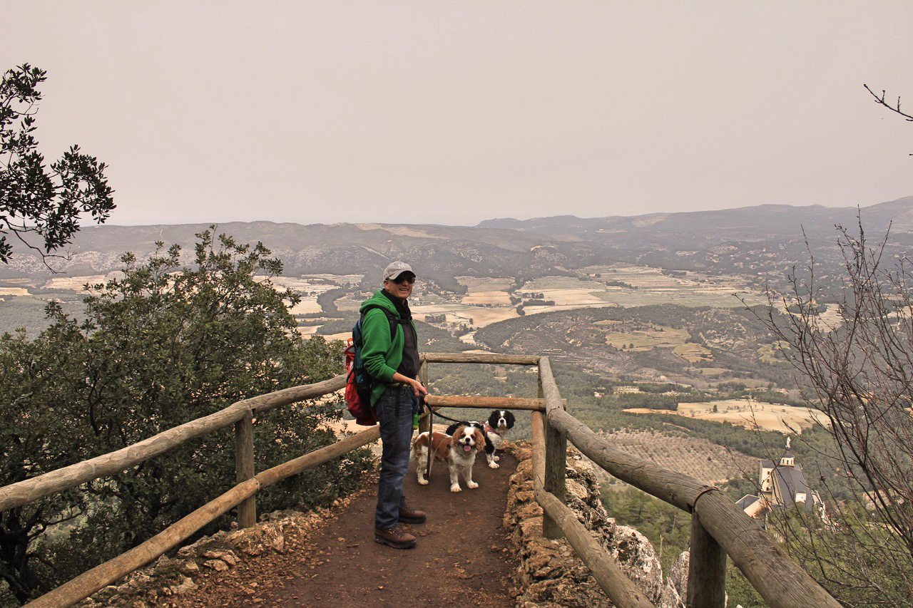
Parque Natural del Carrascal de la Fuente Roja has many routes to follow. We didn’t follow the given routes. We started with the red route and switched to the blue route to get to the peak of Menejador. We visited the peak where there is a fire control tower. At the peak you can see all around the area. It’s definitely worth the climb.

There are beautiful landscapes along the way when you go higher. When you reach Mas de Foiaderetes (picture below on down right corner) you can choose which way to go. If you wanna go up to the highest peak, choose to continue the path going up.
Going further up there is a recreational area where you can have picnic. Again around that area you have option which way to go. We chose to continue to the highest peak.

When we got down from the peak and arrived at the fire control tower, we took a right (under the fire control tower) and went down the path through the woods. You can see an official sign with little “i” signalling to a little path.
From the little path down through the woods you arrive at the ancient coal burning place. After you have looked around that area you can continue up (left when coming down the path through the woods). You eventually arrive to that same recreational area where you can once again sit down and get something to eat. After that we returned the same way we came from.

The whole Parque Natural del Carrascal de la Fuente Roja area seems very nice and it was an interesting day’s adventure. Our hiking day happened on a day when we had Sahara dust over us, so even though the sky was clear, the visibility was low. I bet it’s even more beautiful on a clear day.
The Font Roja natural park was declared on April 13 1987 natural park by the Generalitat Valenciana. It is located in the North of the province of Alicante, between the towns of Alcoy and Ibi. This natural park is one of the best preserved natural areas of the Valencian Community. The protected natural area covers 2.298 hectares and comprises mountainous alignment of El Alto de San Antonio, El Carrascar of the Font Roja and La Teixereta. The summit of the Sierra del Menejador, with 1,356 m of height, is the highest elevation of the park!
Next month we go on foot again,
Hasta luego,
Heidi & Olli